


Transfinite’s Consultancy Service
Transfinite Systems markets specialist software products for radio interference analyses and also offers a world-class consultancy service. Our consultants have considerable experience in developing software simulations applied to complex coexistence studies and practical frequency coordination work.
This page gives an overview of our capabilities and the consultancy work that we do for clients across the world.

Making Tracking Strategies
When modelling non-GSO satellite systems, the geometry is always changing, and so it becomes necessary to consider the method by which the active satellite is selected. In Visualyse Professional, this is done via the Tracking Strategy object, which is used by a Dynamic Link to select an end station based upon rules such as highest elevation. The Tracking Strategy can be used to make sure the “right” non-GSO satellite is active at each time step taking into account factors such as minimum elevation angle and exclusion zones around the GSO arc. This updated Technical Note (TN) describes the Tracking Strategies in Visualyse Professional and describes some of the most common selection methods.

Resolution 770 After WRC-23
The World Radiocommunication Conference (WRC) in 2019 approved Resolution 770 which can be used to determine whether non-GSO FSS systems operating in parts of Q/V band meet the requirements of Article 22 to protect GSO networks. The Resolution included parameters of generic links and an algorithm to calculate the increase in unavailability and loss of throughput due to interference, which could then be compared against the 3% limits in Article 22.5L. During the cycle from WRC-19 to WRC-23, this algorithm was examined further and, while found to be basically sound, minor adjustments were made. This Technical Note (TN) describes these changes and the new regulatory framework.
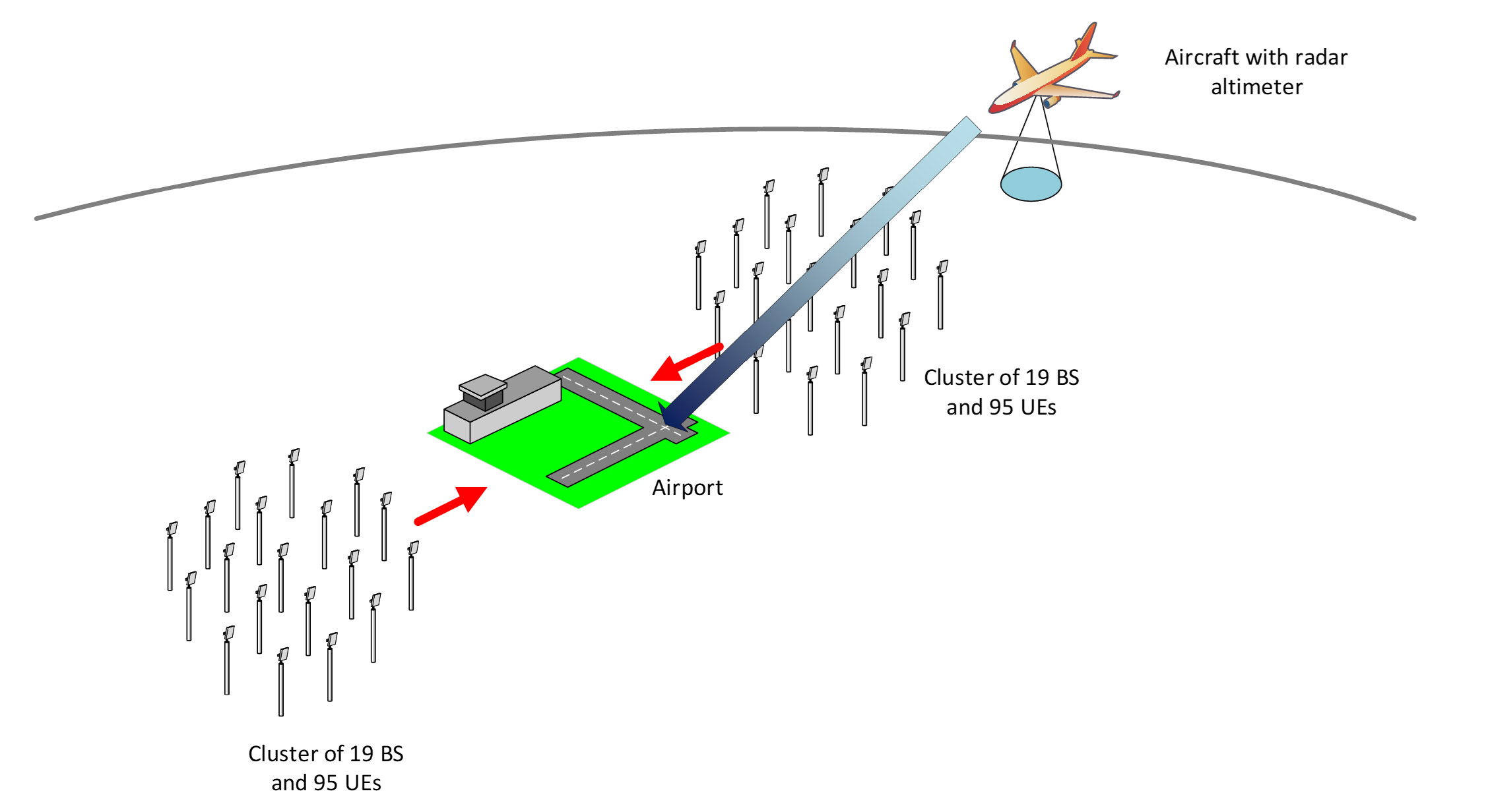
Modelling Interference from 5G System into Radar Altimeters
Portions of the frequency band 3.7 - 4.2 GHz has been reallocated to flexible use including 5G applications. This is close in frequency to the 4.2 - 4.4 GHz band used by radar altimeters on civil aircraft, which is a critical application involving safety of life. Recently there has been concern of the potential of harmful interference from 5G systems into these radar altimeters, in particular when aircrafts are near airports at lower heights close to terrestrial transmitters.
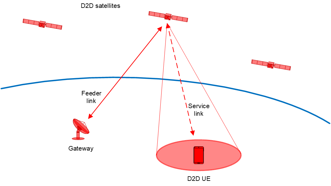
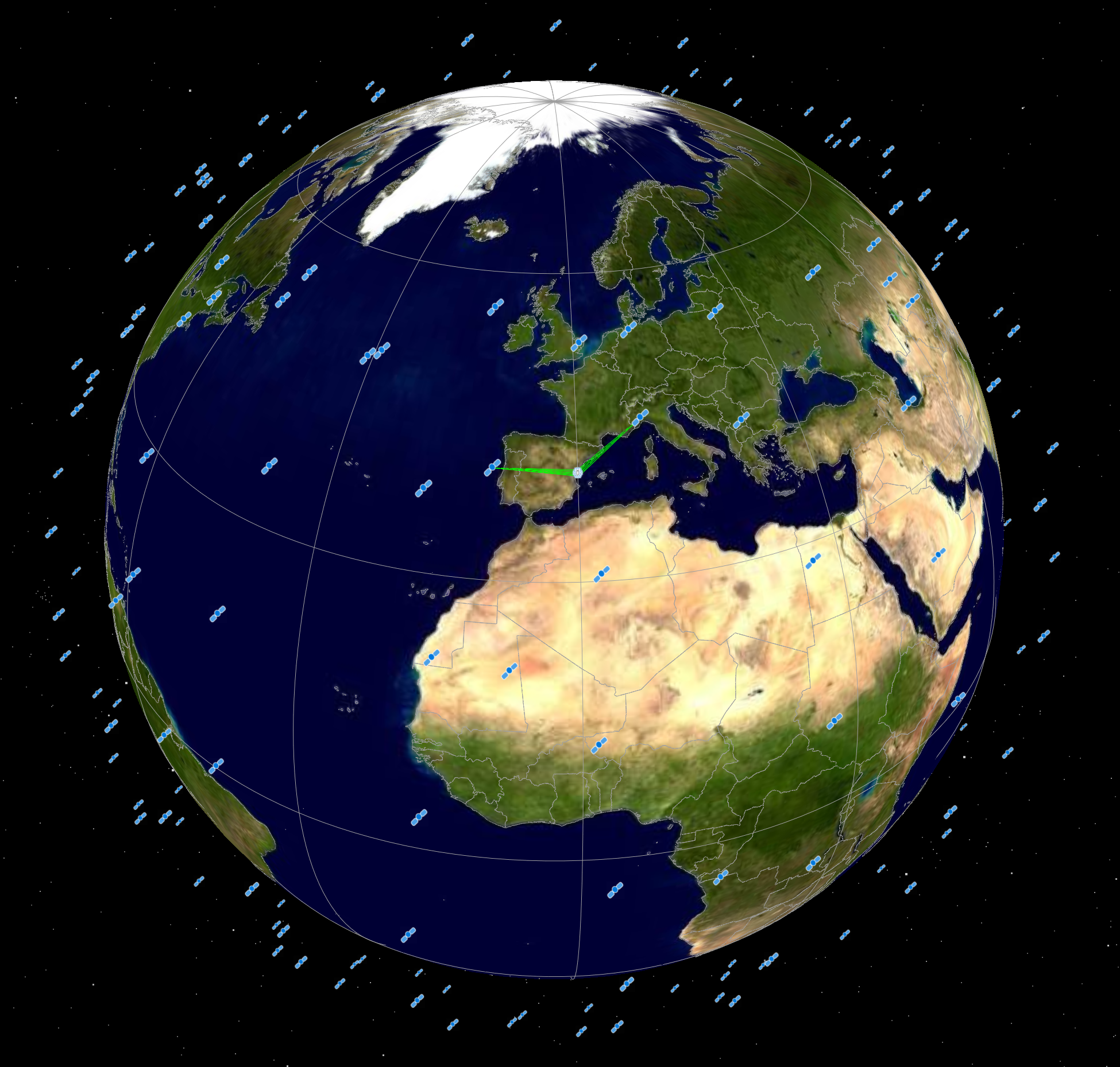
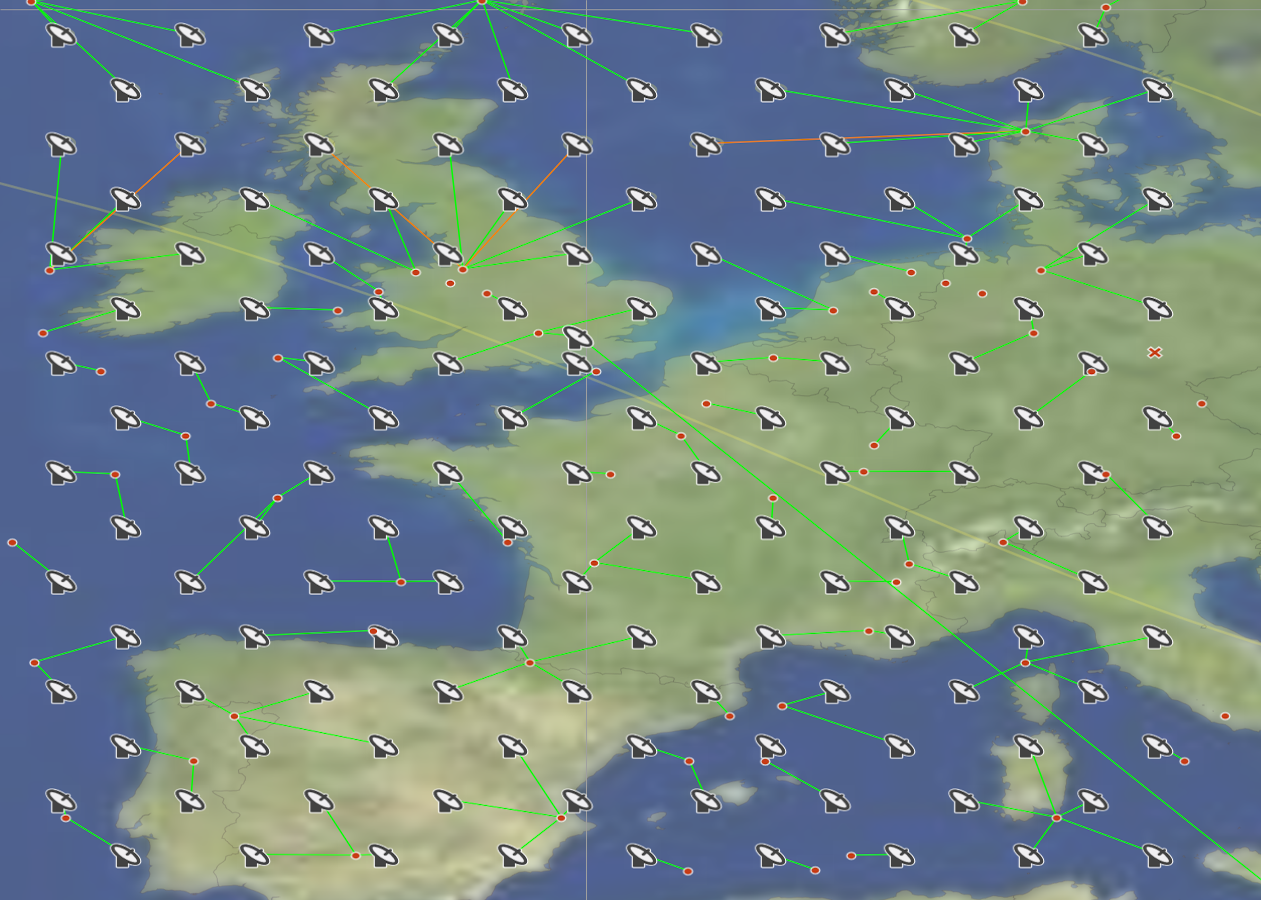
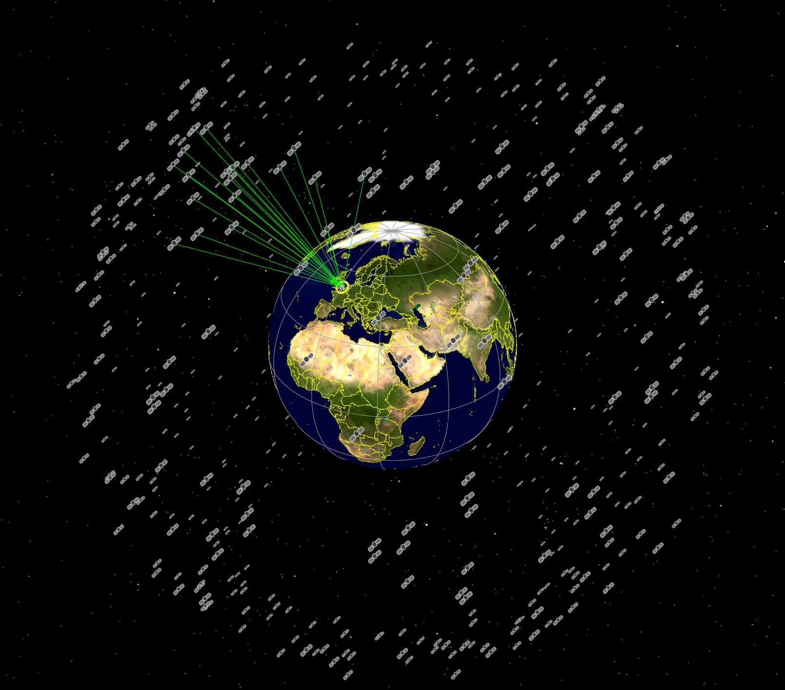
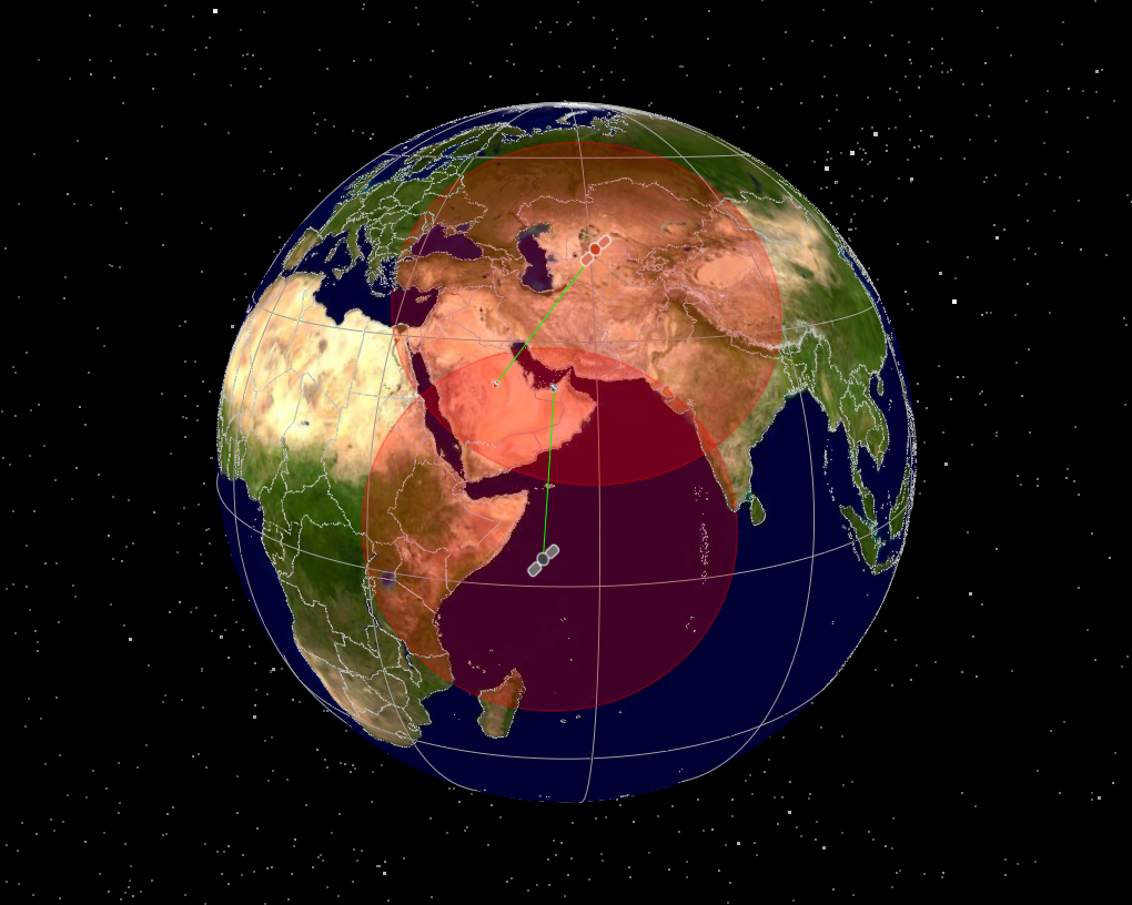
Modelling D2D Systems using Visualyse
There is currently significant interest in the satellite and mobile industries in the potential to provide communication services from satellites direct to users with unmodified handsets. These types of systems are sometimes called direct-to-device (D2D), non-terrestrial networks (NTN) or supplementary coverage from space (SCS) and could involve a constellation of low Earth orbit satellites with large antennas that have the ability to provide such a service. But this brings in technical and regulatory challenges, from the type of services that can be provided, how to optimise coverage, capacity and throughput to the potential for interference to other services including terrestrial networks. This White Paper shows how these types of studies can be undertaken using the Visualyse Professional and Visualyse Interplanetary tools.
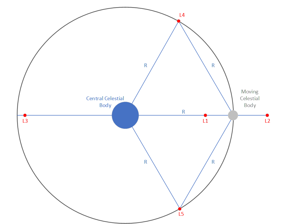
Visualyse Interplanetary: General Satellite Dynamics Update and Lagrange Points
Visualyse Interplanetary has recently been updated with improved general satellite dynamics definition and ability to specify spacecraft to be located at a Lagrange Points, as described in this Technical Note (TN).
Modelling EESS (Passive) Area Based Thresholds in Visualyse Professional
Recommendation ITU-R RS.2017 defines thresholds that can be used as interference criteria when undertaking studies of interference into Earth Exploration Satellite Service (EESS) (passive) systems. This Recommendation defines the threshold in terms of a threshold interference level and a percentage of a reference area that the interference level into a receiver may be exceeded. The threshold interference level, size of reference area and maximum percentage are defined for a range of frequency bands between 1.37 and 956 GHz. This Technical Note (TN) describes ways to model these thresholds in Visualyse Professional.

About Transfinite Systems
We are one of the leading consultancy and simulation software companies in the field of radiocommunications. We develop and market the leading Visualyse products:
- Visualyse Professional
- Visualyse Interplanetary
- Visualyse GSO
- Visualyse EPFD and associated Visualyse PMGT (PFD Mask Generator Tool)

Resolution 169 Analysis in Visualyse
Two of the Agenda Items (AIs) at the forthcoming World Radiocommunication Conference 2023 (WRC-23) meeting relate to the operation of Earth Stations in Motion (ESIMs), namely AI 1.15 and AI 1.16. One of the issues to address under these AIs is the protection of terrestrial services and Resolution 169 (WRC-19), contains PFD limits that aeronautical ESIMS must meet to ensure that protection. This Technical Note (TN) describes how it could be verified that an aeronautical ESIMS meets these PFD limits using analysis undertaken with either Visualyse Professional or Visualyse Interplanetary.
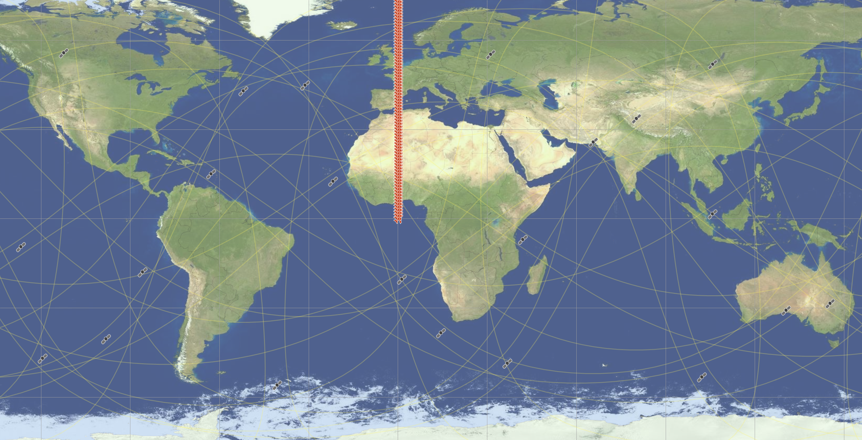
Non-GSO Satellite Coordination
A key part in the regulatory approval of any satellite system is to successfully coordinate the radio frequency assignments involved. This process is defined by national and international regulations, in particular, those of the International Telecommunications Union within the Radio Regulations. This process can seem daunting to those not familiar with it, and requires understanding of regulations, procedures, databases, radio engineering and modelling techniques. This White Paper describes some of the key aspects, such as the ITU process, the databases involved, how to identify whether coordination is required and the detailed coordination process. It shows how these tasks can be supported using the Visualyse suite of tools available from Transfinite Systems.
RNSS Updates to Visualyse Tools
Recent updates to Visualyse Professional and Visualyse Interplanetary have included a number of features that could be used to undertake studies of Radionavigation Satellite Service (RNSS) systems. This includes the ability to undertake analysis using the methodology in Recommendation ITU-R M.1642 to calculate the equivalent power flux density into Aeronautical Radionavigation Service (ARNS) receivers. In addition, the update includes the ability to calculate the geometric dilution of precision (GDOP), a useful metric for RNSS systems. These updates are described further in this Technical Note.
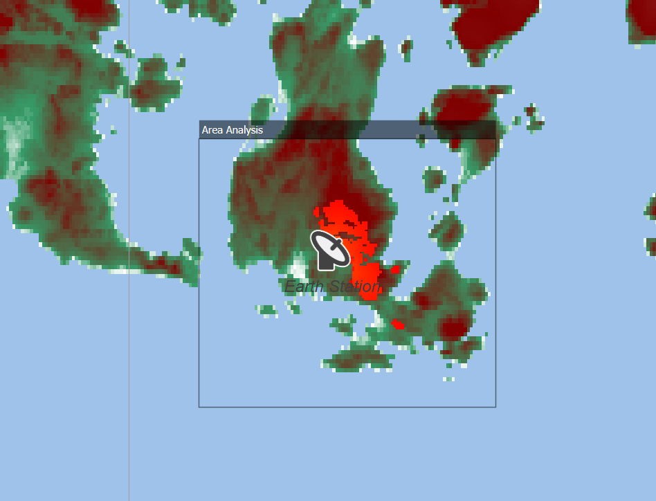
Generating Earth Station PFD Contours
A key component of any satellite system are the Earth Stations (ES). These must be licensed and this regulatory process varies between countries and frequency bands. One common technique is to define a threshold in terms of a power flux density or PFD and for the ES operator to have to derive the contour which shows those locations where the PFD would be exceeded. In some cases there can also be a requirement to identify the population that would be within this PFD contour. This Technical Note (TN) looks at how this information can be generated using Visualyse Professional.